 The Place to Share |
BuyBelowCost - Classifieds Ads for Smart People! |
Hillsborough River State Park, Tampa FL |
 This page Copyright 1999 Alfonso Vazquez-Cuervo - See Terms of Use |
Our Route Summary
|
|
Entry and Exit
|
 |
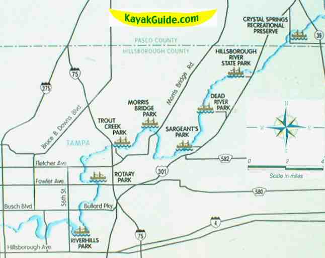
What We SawAs you'll see on the map at left, this state park launch point is one of many access points to the Hillsborough River, one of the most organized and well mapped canoe trials anywhere. And access points are conveniently located in and near Tampa. |
|
| We headed left from the launch area for an impromptu
canoe trip. In the summer on weekends, you may want to call ahead if you plan to rent canoes as the wait can be long. |
|
| You'll pass upland hammocks of large oaks and
magnolia trees as well an an occasional wayward palm tree
stretched over the river. Leave time to tour the Fort Foster Historic Site in the park. It has a reconstruction of a fort that existed during the second Seminole War around in 1837. |
|