 The Place to Share |
 |
|||
|
 Copyright 2001 Alfonso Vazquez-Cuervo - See Terms of Use |
|||
Our Route Summary
|
||||
Entry
|
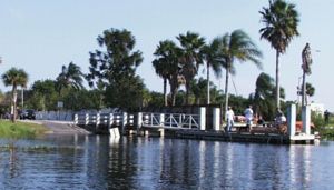 |
|||
Exit
|
 |
|||
 |
What We SawThe St. Johns River is a beautiful, northern flowing river that was once the prime tourist destination in Florida. Before railroads or roads, the St. Johns served as a major thoroughfare with numerous paddle wheel boats. And native Americans used it extensively. The river begins in the marshes of Blue Cypress Lake and ends at it's mouth in Jacksonville. This is the first section of the St. Johns River that sees regular boat traffic. We paddled upstream (southward) from Lake Washington to entrance to the St. Johns on the Lake's southeastern side. Though this is a nice paddle, be prepared for airboat and motorboat traffic. Airboats love the swampy areas along the shores of Lake Washington. But with the exception of one idiot motor boater that came around a blind corner on the river at high speed, we found the boaters polite, friendly and careful to steer clear of us paddlers. I suggest placing a bright, tall warning flag on your canoe or kayak to be more visible above the high grasses. And take a loud horn to warn away boats if necessary. |
|||
| We enjoyed an afternoon paddle along the marshy
shores on the east side of Lake Washington as we paddled
south to the river. The mouth of the river (see photo at
right) is on the southwest side of a peninsula on the
southeast side of the Lake at GPS: N 28 degrees 06.868' W 80 degrees 44.877' You'll come to a couple of smaller canals off the lake first that lead to dredged channels along Eau Gallie Boulevard. This areas is also popular with airboats. |
 |
|||
 |
Once we entered the river mouth toward the east,, it
quickly curved toward the south. It's banks were lined
with grasses with birds such as the small vulture at
left. On narrow rivers frequented by high speed boat traffic, it's best to take the longer, outside shore of sharp curves to help the boaters see you in time to slow down. Good power boaters will do the same, but, like paddlers, not all know what they're doing. There were several islands and branches in the river. We stayed to our right to continue on the main channel. We eventually saw the power lines and Route 192 bridge just before the Camp Holly takeout on the west side of the river. |
|||