
Places to Paddle tm
|  |
An outstanding HD video and automatic photo camera with built-in GPS for paddlers, bikers, surfers, kite boarders, hang gliders, hikers; all of us that love the outdoors! I take mine on every adventure. Al V |
||||||||||||||||
|
 Copyright 2001 Alfonso Vazquez-Cuervo - See Terms of Use |
|||||||||||||||||
Our Route Summary
|
||||||||||||||||||
Entry
|
 |
|||||||||||||||||
Exit
|
 |
|||||||||||||||||
 |
What We SawThe upper "Econ" is a very typical blackwater stream originating from a large area of swamps and seasonally flooded area to the south. The basic habitat is cypress/hardwood swamp or lowland with an occasional area of pine/palmetto reaching to the river’s edge. There is no gauge for the Econ so it is best to call HRP [407]568-5346 for conditions. With low water the river twists and turns in a narrow channel providing numerous maneuvering tests. The occasional downed log will require a pullover at normal water levels but these increase exponentially as the water drops. At high water levels the river leaves its banks and provides an interesting opportunity to paddle through the woods. This provides challenges not only in maneuvering but also finding a clear route. In fact it may be impossible to find the actual channel but there is no possibility of getting lost as eventually the river will become channeled where the banks are higher. As there is little gradient the current isn’t extremely fast although in places it can get pushy so safety should always be a concern. The dark tannic water makes it difficult to see obstacles just under the surface so be prepared to bump into things. Cypress knees especially seem to delight in preying on unsuspecting boaters. Suprisingly, for being this close to Orlando, sights and sounds of civilization are few. The seasoning flooding keeps encroachment to a minimum with only 1 or 2 homes barely visible from the river. |
|||||||||||||||||
| Wildlife can be abundant if you paddle slowly and quietly but does tend to be skittish. Squirrel, otter and deer are the most commonly seen mammals. Wild hog, gray fox and swamp cottontail have been observed. Any of the typical Fl water, swamp or hardwood forest birds may be seen. The most abundant being kingfishers, herons, wood ducks, piliated and other woodpeckers, red shouldered hawks and barred owls. Alligators are seen although not in great numbers and they do tend to be more wary than on some other streams. Snakes are sometimes seen by the very observant but they too seem to be more shy than other places I’ve paddled. A warning to any arachnophobes, banana spiders are very prevalent on the Econ, often with their webs spanning the entire river. Large wolf spiders and other "big Boys" are fairly common so keep an eye out for the smaller creatures. (See photo section.) |  |
|||||||||||||||||
 |
Time to travel this section can vary widely depending
on your paddling style and water level (number of pull
overs in low conditions). It is commonly stated to be a 4
to 5 hour trip. It has been done in just over 2 hrs by a
very fast paddler with the water up. It has also taken
almost 8 hrs when the water was low and we had almost 50
pullovers and little current. These distance traveled
markers along the river may help you judge your rate of
progress: Lake Pickett Road bridge -1.5 miles, 1st power
line - 2 m., 2nd power line - 3 m., (best place to take
lunch if water is high (GPS:
N 28 degrees 35.787' W 81 degrees 09.494'),
The Hidden River Park takeout on river left (HRP) - 5 m.,
a large outflow pipe from a subdivision retention pond on
river right - 7.5 m., and the 419 bridge (Takeout/Exit) -
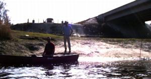
9miles. Hazards on the Econ are more likely to be those less thought of kinds, such as wasp nests, slip and falls while doing pullovers and probably the most dangerous, heat exhaustion. Like almost any endeavor the simple rules apply, pay attention, be careful and be prepared. Plenty of fluid should always be taken on any trip. Raingear is always a good option as afternoon thunderstorm can build quickly. High water levels do create the possibility of strainers so appropriate caution should be observed when the water is up. |
|||||||||||||||||