Places to Paddle tm
Canoeing - Kayaking - Rafting - Fishing

Waccasassa River near Cedar Key, Florida USA
By reading further, you agree to our Terms of Use


Big Old Cypress Tree on the Waccasassa River

Copyright 2010 Closewaters LLC- See Terms of Use

Our Route Summary

  • Submitted by: Al Vazquez, alvazquez@kayakguide.com
  • Date Submitted: 11/2010
  • Location: East of Cedar Key, Florida USA near the Gulf of Mexico
  • Class: typically Class 1
  • Distance Paddled: about 4 miles round trip upstream
  • Water: fresh to brackish and tidal around the downstream area
  • Wildlife: alligators, pelicans, egrets, herons, mullet, cypress trees, live oaks, Spanish moss
  • Special Regulations: none known

Entry and Exit

  • Directions:
  • From Cedar Key, take Route 24 north. Turn right (southeast) onto Route 98/19/55. About 5 1/2 miles, turn right (southwest) onto Route 326. Proceed about 4 miles to the boat ramp.

    If southbound on Interstate 75, exit at Gainesville directly onto Route 24 southwest toward Archer and Bronson. Turn left (southeast) onto Route 98/19/55. About 5 1/2 miles, turn right (southwest) onto Route 326. Proceed about 4 miles to the boat ramp.

    From Interstate 75 northbound from the turnpike, exit at Ocala onto Route 27 northwest. In Williston, take Route 27 ALT northwest to Bronson. In Bronson, turn left onto Route 24. Turn left (southeast) onto Route 98/19/55. About 5 1/2 miles, turn right (southwest) onto Route 326. Proceed about 4 miles to the boat ramp.

  • GPS: N 29.21377 W 082.76353 degrees (actual )
  • Fee: None
  • Description: Cement boat ramp with adjacent small dirt beach
  • Parking: paved and unpaved
  • Facilities: Bench and small dock
  • Special Handicap Access: None

Where We Paddled and What We Saw

From the entry point at the ramp, we paddled to the left to go upstream.

Be careful of motor boat traffic near the boat ramp. It is especially heavy downstream on weekends as this ramp is used by fishermen and clammers to head downstream to the gulf.

Paddling upstream, we kayaked the left fork of the river and paddled under the Route 326 bridge at

GPS: N 29.22139 W 082.75786 degrees (actual )

The river continued to narrow and we found ourselves paddling quiet waters without motor boats.

There was a nice canopy of trees overhead during much of the paddle as we kayaked further upstream.

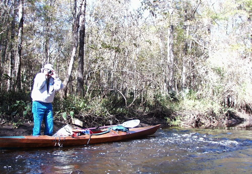
We came to some rapids over what seemed to be a natural dam formed by a ridge of solid rock across the river. Carefully avoiding slipping, we portaged our kayaks over the natural dam and continued paddling over newly quiet and slightly deeper waters.

The river narrowed and we found ourselves paddling through more and more obstructions of fallen trees. After about 2 miles of paddling, we turned around at

GPS: N 29.23501 W 082.74848 degrees (actual )

Near the boat ramp, we saw this alligator sunning itself on the shore. Especially during colder weather, these magnificent cold-blooded reptiles can be found warming themselves on sunny beaches like this one along quieter streams in Florida.

KayakGuide.com Terms of Use

Copyright

The purpose of copyright is to protect contributing authors against the theft of paddling information they publish on KayakGuide.com and to protect KayakGuide.com against the theft of its information organization, format, and web publishing work. Therefore this entire web site is copyrighted with All Rights Reserved except only the following:

KayakGuide.com web pages may be reproduced on paper only if each web page is reproduced in its entirety. Any other reproduction requires the written permission of KayakGuide.com and the author.

KayakGuide.com pages may not be reproduced for profit-making purposes except by the authors and by KayakGuide.com. Businesses may reproduce KayakGuide.com pages but may not charge any fee for those pages.

You may share or link the web addresses (URLs) of KayakGuide.com pages, store them on any computer, and publish them as long as they are always clearly acknowledged as belonging to KayakGuide.com.

Authors of content published on KayakGuide.com retain the copyright to the content they submit except that any other publication on the internet of that content is prohibited without written permission from KayakGuide.com.

Authors of paddling routes have unlimited rights to reproduce photos they publish on KayakGuide anywhere.

By submitting information for publication to KayakGuide.com, the author irrevocably grants KayakGuide.com permission to publish that information on KayakGuide.com. Authors also grant permission for others to reproduce that information only under the limited conditions of our terms of copyright.

Waiver of Liability

By reading or using any information on KayakGuide.com, you agree not to hold the owners, employees, service providers, advertisers, partners, or content authors of KayakGuide.com responsible for any errors or for any mishaps or losses you may have as a result of any information on this web site.

You understand and acknowledge that water levels, currents, and other paddling conditions can vary from those described herein and that you assume all risks associated with paddling these routes or using any information on KayakGuide.com.

You acknowledge that the information on KayakGuide.com is not a substitute for the first hand knowledge of a qualified guide with recent paddling experience on these bodies of water.

Responsible Use

You acknowledge that kayaking, canoeing, and similar water sports carry an inherent risk. You agree to undertake such sports safely and responsibly, with appropriate training and equipment.

You agree to adhere to the Closewaters Principles to protect our natural environment and enhance the experience of others.

Integrity of Information Contributed

Sharing useful information is at the heart of KayakGuide.com. By contributing any information to KayakGuide.com, the contributor agrees:

Trademark

KayakGuide.com, KayakGuide, and "Places to Paddle" are Trademarks of Closewaters LLC.

Thank you for your support and cooperation.